


Alban Voting District, Fairfax County, Virginia
About
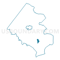
Outline

Summary
| Unique Area Identifier | 681642 |
| Name | Alban Voting District |
| County | Fairfax County |
| State | Virginia |
| Area (square miles) | 1.67 |
| Land Area (square miles) | 1.64 |
| Water Area (square miles) | 0.02 |
| % of Land Area | 98.53 |
| % of Water Area | 1.47 |
| Latitude of the Internal Point | 38.74024670 |
| Longtitude of the Internal Point | -77.20588200 |
Maps


Graphs
Select a template below for downloading or customizing gragh for Alban Voting District, Fairfax County, Virginia


Neighbors
Neighoring Voting District (by Name) Neighboring Voting District on the Map
- Garfield Voting District, Fairfax County, VA
- Lorton Center Voting District, Fairfax County, VA
- Lorton Station Voting District, Fairfax County, VA
- Pioneer Voting District, Fairfax County, VA
- Saratoga Voting District, Fairfax County, VA
- West Springfield Voting District, Fairfax County, VA
Top 10 Neighboring County Subdivision (by Population) Neighboring County Subdivision on the Map
- Lee district, Fairfax County, VA (128,453)
- Mount Vernon district, Fairfax County, VA (106,296)
- Springfield district, Fairfax County, VA (101,682)
Top 10 Neighboring Place (by Population) Neighboring Place on the Map
- Springfield CDP, VA (30,484)
- West Springfield CDP, VA (22,460)
- Lorton CDP, VA (18,610)
- Newington CDP, VA (12,943)
Top 10 Neighboring Unified School District (by Population) Neighboring Unified School District on the Map
Top 10 Neighboring State Legislative District Lower Chamber (by Population) Neighboring State Legislative District Lower Chamber on the Map
- State House District 42, VA (81,840)
- State House District 39, VA (78,182)
- State House District 43, VA (78,088)
Top 10 Neighboring State Legislative District Upper Chamber (by Population) Neighboring State Legislative District Upper Chamber on the Map
Top 10 Neighboring 111th Congressional District (by Population) Neighboring 111th Congressional District on the Map
Top 10 Neighboring Census Tract (by Population) Neighboring Census Tract on the Map
- Census Tract 4316, Fairfax County, VA (8,219)
- Census Tract 4221.01, Fairfax County, VA (6,674)
- Census Tract 4315, Fairfax County, VA (5,325)
- Census Tract 4210.02, Fairfax County, VA (4,947)
- Census Tract 4327.02, Fairfax County, VA (4,325)
- Census Tract 4220, Fairfax County, VA (3,439)
- Census Tract 4327.01, Fairfax County, VA (3,210)
- Census Tract 4328, Fairfax County, VA (2,241)
- Census Tract 9801, Fairfax County, VA (10)